Surveyor Topographical
Explore career options on our platform! find your
perfect match for your future job.
Overview
A Surveyor Topographical, also known as a Land Surveyor, is responsible for measuring and mapping the earth’s surface. They use advanced technology, including geographic information system (GIS) and global positioning system (GPS), to determine longitudes, latitudes, contours, and shapes of different terrains. Their work is crucial for various activities such as construction, mapmaking, and legal boundary determinations.
Key Roles and Responsibilities of a Surveyor Topographical
Surveying
Conduct surveys to determine precise location and measurements of points, elevations, lines, areas, and contours on the earth's surface.
Equipment Operation
Operate and maintain the technical instruments used in surveying, such as theodolites, levels, and GPS systems.
Data Analysis
Analyze data and prepare maps, graphs, and reports.
Legal Documentation
Prepare and maintain sketches, maps, reports, and legal descriptions of surveys to describe and certify work performed.
Client Consultation
Consult with clients to provide advice and explanation about the survey process and findings.
Collaboration
Work with civil engineers, landscape architects, and urban and regional planners.
Field Work
Conduct field work in various weather conditions and terrains.
Compliance
Comply with laws, regulations, and industry practices, including using the appropriate symbols and terminology for the maps.
How to Become A Surveyor Topographical?
Path 1
1.

12th
Science (Maths)
2.

ITI/Diploma
Diploma in Civil Engineering (Specialization: Surveying)
3.
UG
B.Tech in Civil Engineering (Specialization: Surveying)
4.

PG
M.Tech in Geomatics (Specialization: Surveying and Geoinformatics)
Path 2
1.
12th
Science (Maths)
2.
UG
B.Sc in Geoinformatics (Specialization: Surveying and Mapping)
3.
PG
M.Sc in Geoinformatics (Specialization: Surveying and Mapping)
4.

Certification
Certified Surveyor (CS), Geographical Information Systems Professional (GISP)
Want to become a Surveyor Topographical
Find out if this role fits with your skills and interests.
What Skills are Required for a Surveyor Topographical?
Technical Skills
Analytical Skills
Soft Skills
Career Opportunities for a Surveyor Topographical
Junior Surveyor
Surveyor
Senior Surveyor
Survey Project Manager
Chief Surveyor
Surveyor Topographical Work Profile
Environment
Field work in various weather conditions and terrains along with office work for data processing and report writing.
Hours
Standard office hours with potential overtime for field work.
Interaction
Regular interaction with clients engineers architects and planners.
Travel
Frequent travel to survey sites.
Remote Work
Limited opportunities for remote work.
Job Opportunities
High demand in sectors like construction real estate public work and resource extraction.
Learning Curve
Continuous learning to keep up with advancements in surveying technology.
Pros and Cons of Being a Surveyor Topographical
Strengths
Diverse work environments
Opportunities to work outdoors
Involvement in major development projects
High demand for skills
Possible Constraints
Physically demanding work
Potential for long hours
Work in all weather conditions
High precision required leading to stress
Ready to advance your career in Surveyor Topographical?
Let our experienced counsellors help you make informed choices for a successful future.
Top Surveyor Topographical Companies




Top Exams for Surveyor Topographical
Famous Surveyor Topographical Personalities
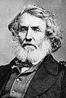
Col. Sir George Everest
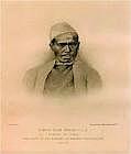
Nain Singh Rawat

Lt. Gen. Girish Kumar
Sign Up for the Latest Updates & News
Please note that the data provided is for informational purposes only and intended to give a general understanding of the career. We recommend consulting career counsellors before making any career decisions.

100+

Professionals are ready to help you!
Confused About Career?
Talk to our Expert
Our team of career counselors consists of seasoned professionals with years of experience and specialized qualifications, dedicated to helping you achieve your career goals with personalized and expert advice.

Personalized Guidance
Comprehensive Career Planning
Expert Advice
Flexible Scheduling
Proven Success
Holistic Approach
invest4Edu is now on iOS & Android !
One Tap, Endless Possibilities